Trail Walking La Tour - 17-04-2022 Le tour de Saint Jean de Tholomé  - Photo

17-04-2022 Le tour de Saint Jean de Tholomé

 Kargil
Kargil

User GUIDE

© OpenStreetMap contributors
Length
Length
21 km
Max alt
Max alt
1067 m
Uphill gradient
Uphill gradient
716 m
Km-Effort
Km-Effort  
31 km
Min alt
Min alt
599 m
Downhill gradient
Downhill gradient
709 m
Boucle
Boucle
Yes
Creation date :
2022-04-17 08:37:22.904
Updated on :
2022-04-17 16:44:51.201

(0 Reviews)

Walking
Walking
5h19
Difficulty : Difficult

Scan this QR Code to open this trail in the SityTrail application

FREE GPS app for hiking

Logo SityTrail SityTrail

IGN / Geographical institutes

Download SityTrail from the App Store Download SityTrail from Google Play

Logo SityTrail SityTrail World

The world is yours!

Download SityTrail from the App Store Download SityTrail from Google Play Download SityTrail on Huawei AppGallery

About

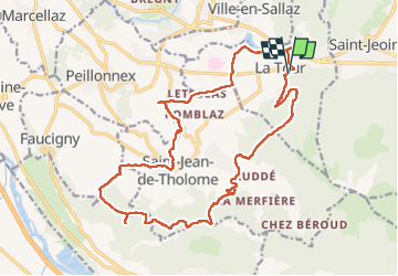
Trail Walking of 21 km to be discovered at Auvergne-Rhône-Alpes, Upper Savoy, La Tour. This trail is proposed by Kargil.

Description

Les moins :
-Un premier tiers sur routes de campagne goudronnées avec peu de passage et majoritairement possibilité de marcher sur le bas côté en herbe.
-Des travaux forestiers ont largement modifiés la cartographie

Les plus :
-Une distance non négligeable avec un dénivelé correct
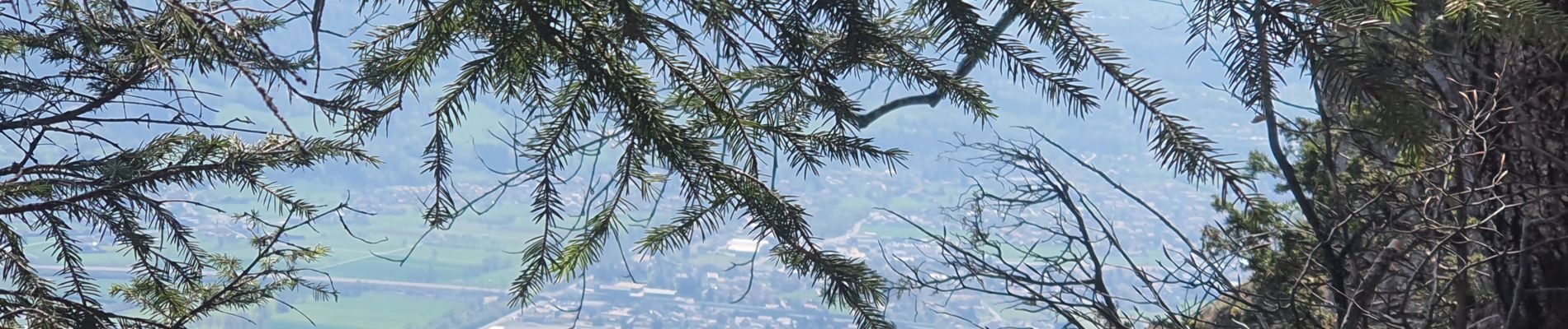
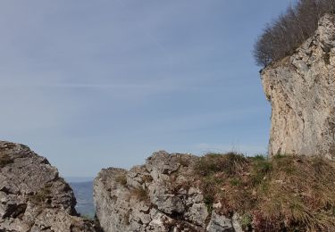
-De belles vues de Alpes à Jura puis Jura à Alpes
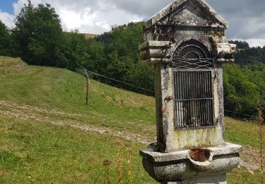
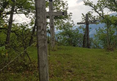
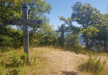
-Des lieux remarquables comme le chemin de croix d'Orgevat
-Des travaux forestiers qui ont permis un itinéraire hors sentier (sur l'arrête du Dard et au Chargieux)
Le sentier pointillé à gauche du point 1048 n'existe plus. La descente se fait en ligne droite dans une belle pente.
Un détour par Le Grand Château depuis le Reray (il suffit de continuer tout droit) peut constituer un beau bonus.

Elevation profile

Photos

Positioning

Country:
France
Region :
Auvergne-Rhône-Alpes
Department/Province :
Upper Savoy
Municipality :
La Tour
Location:
Unknown
Start:(UTM)
301770 ; 5111935 (32T) N.

Trails nearby

Trail Walking Viuz-en-Sallaz - Viuz-Les Brasses-Vernant-Viuz - Photo
Walking
GUIDE
Kargil

Walking

Medium
Viuz-en-Sallaz, Auvergne-Rhône-Alpes, Upper Savoy, France
12.1 km | 25 km-effort
4h 9min
Yes
Trail Walking Bonneville - Tour du Reyret - Photo
Walking
GUIDE
Kargil

Walking

Easy
Bonneville, Auvergne-Rhône-Alpes, Upper Savoy, France
10.6 km | 19.3 km-effort
4h 0min
Yes
Trail Walking Ayse - Les Gallinons - Crêtes du Rocher de l'aigle - Les Gallinons - Photo
Walking
GUIDE
Kargil

Walking

Easy
Ayse, Auvergne-Rhône-Alpes, Upper Savoy, France
8.8 km | 17.3 km-effort
3h 55min
Yes
Trail Walking Bonneville - Chemin de Croix d'Orgevat par Le Reyret - Photo
Walking
GUIDE
Kargil

Walking

Easy
Bonneville, Auvergne-Rhône-Alpes, Upper Savoy, France
9.5 km | 17.1 km-effort
3h 1min
Yes
Trail Walking Ville-en-Sallaz - 2020-07 Lac du Môle - Saint Jeoire - Photo
Walking
GUIDE
Kargil

Walking

Easy
Ville-en-Sallaz, Auvergne-Rhône-Alpes, Upper Savoy, France
9.8 km | 13.1 km-effort
2h 24min
Yes
Trail Walking Marignier - Le Môle par l'arrête Nord. - Photo
Walking
biollay

Walking

Difficult
Marignier, Auvergne-Rhône-Alpes, Upper Savoy, France
6.9 km | 14.5 km-effort
2h 11min
Yes
Trail Walking Marignier - Le Môle par l'arrête Nord. - Photo
Walking
biollay

Walking

Difficult
Marignier, Auvergne-Rhône-Alpes, Upper Savoy, France
6.9 km | 14.5 km-effort
2h 11min
Yes
Trail Mountain bike Peillonnex - Crêtes de Vouan Ludran descente Foron de Viuz - Photo
Mountain bike
julienmerlin

Mountain bike

Medium
(1)
Peillonnex, Auvergne-Rhône-Alpes, Upper Savoy, France
20 km | 28 km-effort
1h 47min
Yes
Trail Running Saint-Jean-de-Tholome - Sortie Longue GR1 - 17/04 - Photo
Running
sim1491

Running

Difficult
(1)
Saint-Jean-de-Tholome, Auvergne-Rhône-Alpes, Upper Savoy, France
27 km | 50 km-effort
4h 0min
Yes


Close
My subscriptions